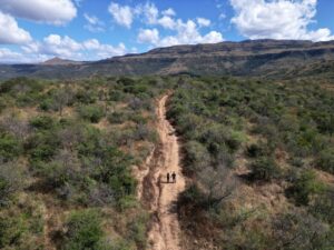
Tour de Mont Blanc is one of the world’s top hiking experiences. Spanning 105 miles (170 km) through the heart of the European Alps, you will get to traverse France, Switzerland, and Italy on foot. What sets this remarkable trek apart is the convenience it offers – a network of charming hotels and cozy mountain huts awaits weary travelers along the route, lightening the load and negating the need for heavy camping gear or tons of food. Expert companies can arrange lodging and even baggage transfer, ensuring a hassle-free adventure so you can really immerse yourself in the mountains. One of the most epic hikes on this planet, Tour de Mont Blanc is surely not one to miss. Here’s our guide on everything you need to plan your own Mont Blanc adventure!
WHEN TO GO
The best time to hike Tour de Mont Blanc is mid-June to mid-September. Early June can come with heavy amounts of snow still on the trail. July and August have the longest days with the warmest weather, but this also means more crowds. September will bring cooler temperatures and less crowds. Many lifts and mountains close in October.
TRIP PLANNING
Tour de Mont Blanc is very popular and lodging can get booked up, especially during high season. For this reason, it is recommended to have your lodging booked in advance.
This can get tricky as you will need to make bookings in three different countries in the different languages. We were traveling with a large group of friends (8 of us) and wanted to have a stress-free experience. For this reason, we decided to hire a company to make our bookings for us.
We used Mont Blanc Treks, which offers both guided and self-guided options as well as full trek and abbreviated 7 day versions. We opted for the bag transfer as well since our group had some novice hikers. They were excellent to work with, very accommodating, and the package was affordable. Highly recommend!
CONDITIONING/SAFETY
This is a difficult hike! You will be doing on average 10 miles/day, usually with at least 2000-3000 ft elevation gains/descent. Make sure you are honest with yourself when deciding if this hike is for you.
Most healthy individuals that exercise regularly should be able to do this hike, but we would recommend conditioning with several long hikes before signing up.
Even if you are fit, trekking with a large and heavy pack requires next-level endurance. Many companies offer bag transfer services where your large pack can be transferred via vehicle to the next town so you can hike with just a day pack. We did this and were very happy with our decision!
The trail is very well marked making it pretty difficult to get lost, but if you are not comfortable with basic navigation consider going with a group or guide (Mont Blank Treks offers guided group treks as well). Always hike with a GPS, ideally with SOS services. We carry our Garmin inReach mini with us everywhere we go.
You will be in the mountains where conditions can quickly become unpredictable. Be prepared for all four seasons and always hike with a buddy if possible.
WHAT TO PACK
- 1 warm weather hiking outfit (shorts, tank, light socks)
- 1 cold weather hiking outfit (pants/legging, long sleeve, warm socks)
- 1 puffer
- 1 rain jacket
- Hiking boots
- Pajamas
- 1 clean outfit to change into at refuges
- Sandals for when your boots are off
- Sun protection: sunglasses, hat, sunscreen
- Cold protection: beanie, buff/scarf, light gloves
- 1 swimsuit
- Day pack
- Trekking poles
- Water bottles or camelback with at least 2L capacity
- Water purifying system (we love our Befree***)
- Bathroom bag with toiletries (toothbrush, toothpaste)
- Microfiber towel
- Head phones
- Camera
- GPS/paper map
- Emergency kit
- Comfortable backpacking pack if no bag transfer
If you are carrying your own equipment you will want to travel VERY LIGHTLY! It’s a hard trek and you will feel every ounce of weight. If you plan for rest days in Courmayeur you can do laundry there and reuse clothes! Don’t overpack!
WHERE TO START
Our trek started in Chamonix, France. However, the closest airport to fly into is Geneva, Switzerland. We recommend flying into Geneva at least 2-3 days before your trek begins in order to adjust to the jet lag prior to hiking.
Consider spending a few days in or around Geneva. We spent the night in Hôtel Les Arcades, which was super convenient as they provide you with a free Geneva transport card which you can use to take the train from the airport to the Cornavin train station which is in the heart of Geneva and right across the street from the hotel. Basic rooms but a great location to price ratio!
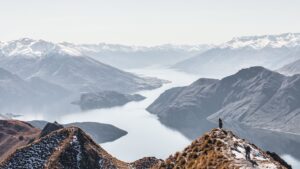
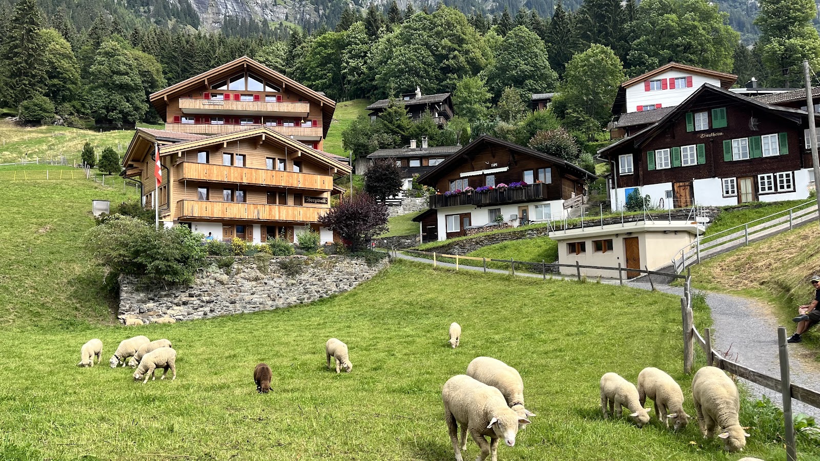
We then spent two nights in the absolutely magic Lauterbrunnen region of Switzerland. Imagine gorgeous Swiss homes surrounded by mountains, cows, and flowers. You will feel transported into a fairy tale world. It is about 2.5 hours away from Geneva. We rented a car, but you could easily take a train.
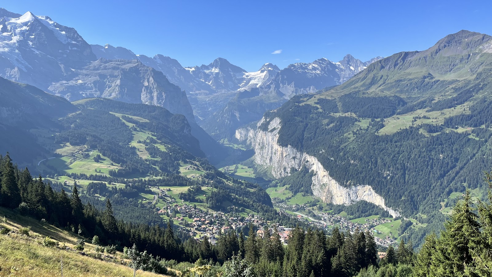
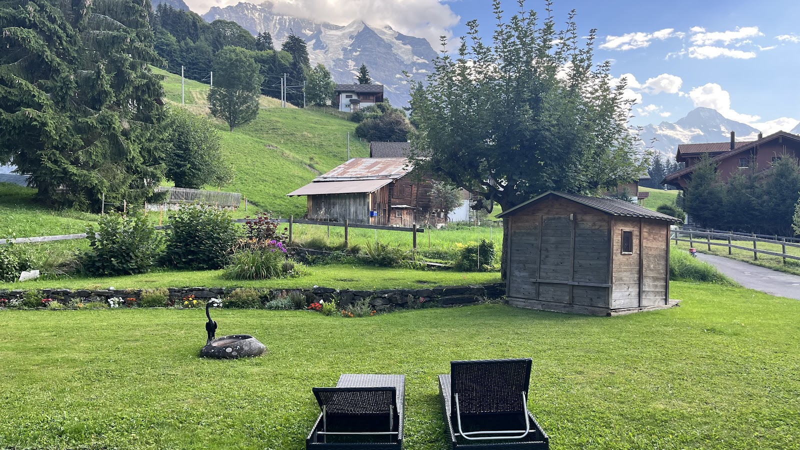
Traveling in Switzerland can get very expensive, so staying at Residence Brunner was a great value. Located in the adorable small town of Wenden, which you can only access via train from the Lauterbrunnen station (park your car in the park house at the train station), not only was the basic accommodation a good deal for the area but the views were absolutely incredible.
You can hop around by train and gondola in the Lauterbrunnen region or hike from town to town. The towns of Grindelwald and Lauterbrunnen have tons of shops and restaurants, but are a little more touristy than Wendon. Take a 45 minute gondola up to Jungfrau, at 13,642 ft (4,158m) nicknamed the “Top of Europe”. Make sure you grab a meal at Hotel Restaurant Bären, you won’t regret it.
TOUR DE MONT BLANC TREK
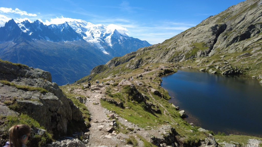
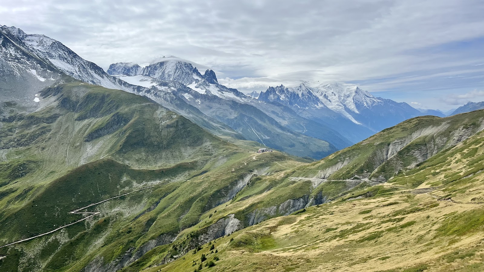
DAY 1: CHAMONIX TO LES HOUCHES
Total distance: 11km
Time: 6-8 hours
We spent the night before our trek in Chamonix and stayed at Pointe Isabelle Hotel, a nice 3-star hotel with fantastic central location and nice amenities. Breakfast was included and they had a nice spread. Great place to start and end your journey.
Our self-guided with Mont Blanc Treks started from Chamonix, although some treks will start at Les Houches. To be honest, it was a brutal first day give the steep elevation gain and descent. The towns of Chamonix and Les Houches are actually very close to one another, but the hike did give us some incredible views.
We started this day by taking the cable car up to Planpaz, which takes you up to 2000m. There is a cafe and toilet up there.
We then followed signs for Col du Brevent making the steep ascent to 2368m. We continued to follow signs from Le Brevent to Lac Brevent which makes for an excellent picnic spot with great views.
We then headed towards Refuge Bel Lachat, where you can buy food and drinks. Of note, there were no stream crossings to fill your water bottle, so this was the last place to purchase water for the day. From here you make a brutal descent down towards Les Houches. Definitely pack your hiking poles.
We ended our night at Hotel Campanules, which was absolutely gorgeous with great service, beautiful outdoor terraces, and a wonderful 3 course meal. A wonderful place to end the night.
DAY 2: LES HOUCHES TO CONTAMINES
Total distance: 13km
Time: 5-6 hours
Day 2 is much better than day 1- less distance and less steep inclines/declines. First take the cable car to Bellevue to 1801m.
After the cable car, follow signs for Col du Tricot. You will cross a suspension bridge over a gorgeous water outflow from Bionnassay Glacier.
After a 400m ascent, you will make a long, boring 560m descent towards Chalets des Miages and Chalets du Tricot. There is a small cafe at Chalets du Tricot and you will pass a stream and water-filling station at Chalets des Miages.
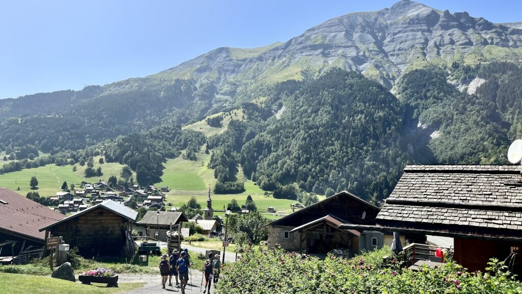
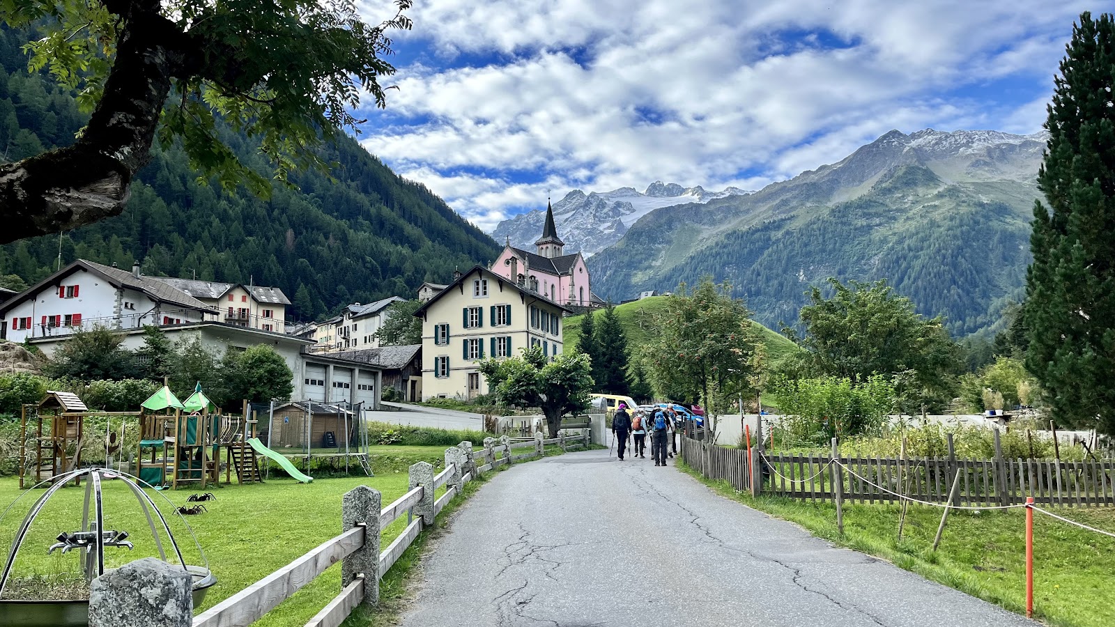
Lastly, make the final descent towards Les Contamines, which is an incredibly cute little town. There is a Spar grocery store in town if you need to stock up on any goods. There are many restaurants and bars around as well.
We stayed at Hotel Christiania, a 2 star hotel that had a much-needed pool. Service and food was hit or miss. Lots of judgey locals around. Rooms were basic and comfortable.
DAY 3: LES CONTAMINES TO CHAPIEUX
Total distance: 19.5 km
Time: ~8 hours
We started off the day with a pleasant flat stroll along the river to the church Notre Dame de la Gorge.
The ascent starts as you follow signs towards Col du Bonhomme. Although a few parts become very steep, most of it is at a pretty gradual incline. You will pass through a beautiful gorge, through pastureland, eventually climbing to Refuge la Balme, where you can get a refreshment.
Continue upwards towards Col du Bonhomme and then to Col de la Croix du Bonhomme. There are fantastic views from this area and it makes for a great picnic spot.
To top it off, treat yourself to a beer at Refuge Bonhomme before making the several mile descent towards Chapieux. Be careful as parts of the trail are over a rock scramble and it can be easy to accidentally get off trail. This is a long day so start early.
Chapieux is one of the most remote towns of the TMB trail. We stayed at Refuge Nova which has dorm-style shared bunks with shared showers. Although the accommodation was very summer-campy, they made up for it with their delicious four-course dinner (our favorite thus far!). There is a lovely river to dip your sore feet in nearby and a great little bar down the street.
There are a few river crossings to refill your water as well as a drinking fountain at Refuge Bonhomme. Much of the trail on this day is exposed to the sun. Conditions towards higher elevations can become windy.
DAY 4: CHAPIEUX TO COURMAYEUR
Total distance: 30km or 20 km with optional Val Veny bus at end
Time: 6-11 hours
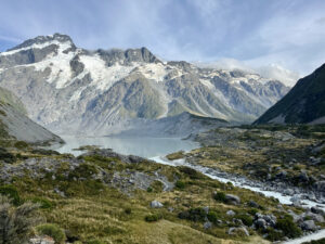
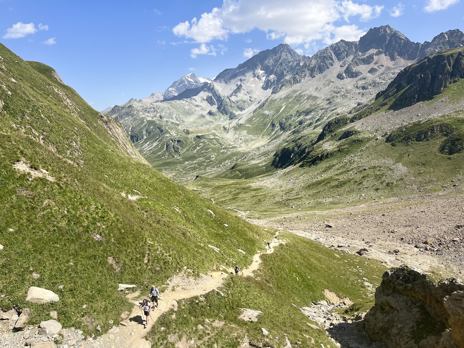
Today you cross from France into Italy. Although it is a long day, it is also one of the most beautiful thus far. You will be greeted with cows, glaciers, and snowcap mountains. Make sure you get an early start to the day since you will be hiking the most mileage if doing the whole thing.
If you are feeling wary today, you have the option of taking a bus (Navette) in the beginning to eliminate the first 4.5km and another at the end (Val Veny) to eliminate the last 10km.
To start the hike, head towards Ville del Glaciers for the first 4.5km. The trail then connects to TMB towards Refuge Les Mottets, where you can stop for refreshments.
From here you will make the zig zag climb towards Col de la Seigne at 2516m. Thankfully it is fairly gradual. You will now be blessed with fantastic views of the Italian side of Mont Blanc.
Then begins the descent down into Val Veny, passing by some old World War II Italian ruins. Make sure to stop by Refuge Elisabetta for amazing glacier views and absolutely delicious Italian food ! Grab a coffee and try the bleu gnocchi.
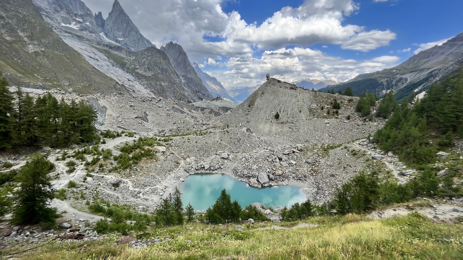
From Elisabetta continue your gradual decline and flat walk to Lac Combal. If you are tired, turn right after the bridge and follow signs towards La Visaille where you can take a bus to Courmayeur and save 10km.
**There is an excellent short hike to Lac du Combal on your way down with a beautiful heart-shaped teal lake which makes for a refreshing swim.
If continuing onwards, take the TMB path to L’Arp Vielle on the right just before the bridge. Continue ascending to Mont Fauvre Spur. You will follow the ridgeline with fantastic views and pass by the Courmayeur skiing area.
Follow signs to Refuge Maison Vielle and then Plan Checrouit for the long descent to Dolonne. If the cable car is running, consider taking it down to save your knees. From Dolonne it is a pleasant, charming walk to Courmayeur.
Avoid trying to hike to Col de la Seigne if there is poor weather and opt for buses instead. There are refreshments and food at Refuges Mottets and Elisabetta.
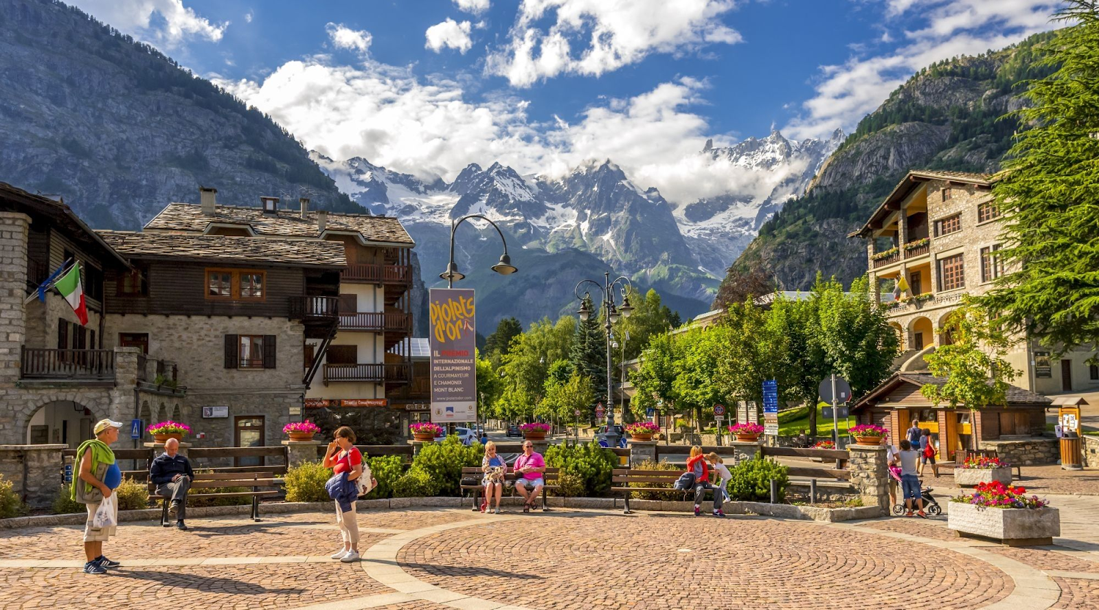
We stayed at Hotel Croux in Courmayeur for 3 nights. Courmayeur is an adorable Italian mountain city with lots of restaurants, bars, shops, pharmacies, and makes a great middle point to restock and have some rest. The hotel has spacious rooms with beautiful views and our favorite breakfast with made to order crepes. Delicious!
DAY 5-7: COURMAYEUR (+/- LAVACHEY)
Total distance to Lavachey: 14km
Time: 6-7 hours
We highly recommend taking 1-2 rest days in Courmayeur. You can hike to Lavachey as a day trip for some great views if you get good weather. To start the hike, take the narrow old road in between the church and guide’s office towards Villair.
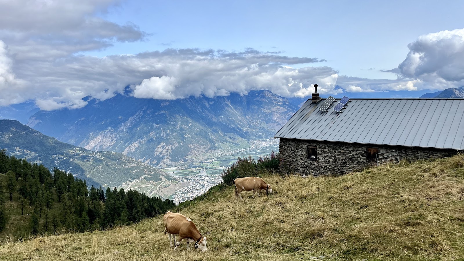
Follow the track left over the bridge and then towards Refuge Bertone, where there are great food and views. From the refuge, ascend 5 minutes and take the left/straight on path (NOT the Mont de La Saxe path). Continue ascending to Alp Lauchy and straight across the pastureland.
Descend to Alp Arminaz and then Refuge Bonatti and then Lavachey. From Lavachey you can take a bus back to Courmayeur. The bus runs hourly and you can find timetables at www.savda.it.
Take plenty of water as the water fountain at Refuge Bertone can dry up. There is also a stream along the way and water at Refuge Bonatti. This trail can be attempted in bad weather as you do not go too high.
DAY 8: COURMAYEUR TO LA FOULY
Total distance: 15.5km
Time: 6-7 hours
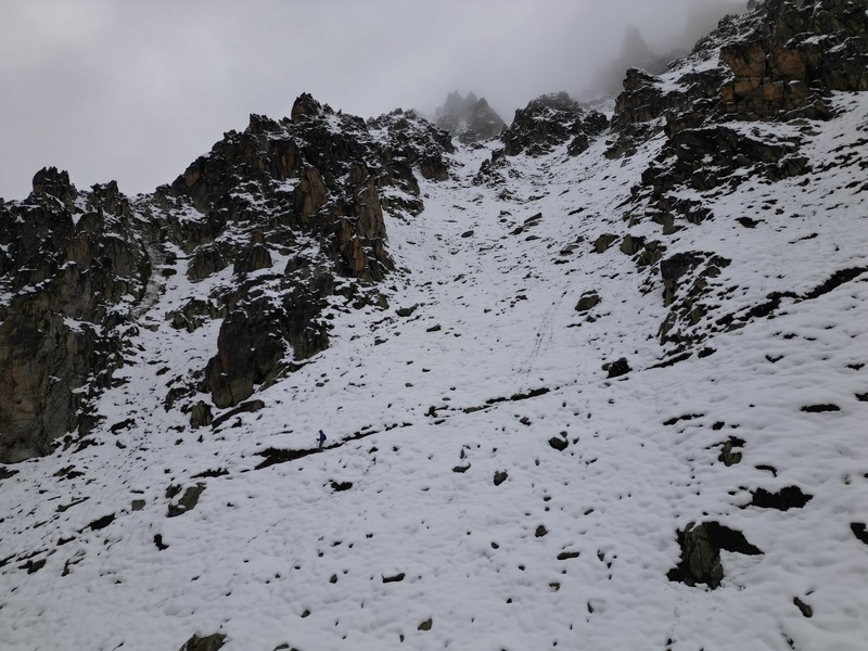
This is one of the more dangerous days of the TMB as you will be crossing a mountain pass, and should therefore only be attempted with good weather conditions. Avoid and take alternative transportation if there is heavy rain or actively snowing. Take gloves and plenty of layers as the higher elevations can be covered in snow even into the later season. Just below Refuge Elena the path crossed a gully a very fast flowing river, cross with caution!
Make sure you get an early start today as you will need to take the public bus from Courmayeur to Arnuva, the last stop of the Val Ferret bus. Once in Anurva, take the TMB path towards Refuge Elena. Grab a morning coffee here if you need!
We were met with heavy rain and high speed winds on this day. We were told by multiple other trekkers that conditions were too dangerous and were advised to not attempt. If this happens to you, take the bus back to Courmayeur. From here you can bus hop from Courmayeur to Aosta to Orsieres to La Fouly which will take ~four hours. Or you can hire a private taxi like we did and get there in two hours.
If conditions are right, follow signs towards Grand Col Ferret which is at 2537m at the Italian-Swiss border. This Col is known to have its own microclimate so come prepared! Views are said to be excellent.
From here you will descend to La Peule at 2071m. There is a refuge here with beers and a dairy farm. We backtracked and did the TMB hike to La Peule which was steep and muddy. Instead, follow the 4×4 track for an easier descent to La Fouly & Ferret.
La Fouly is a tiny village with a small supermarket. We stayed at Auberge du Glaciers which had basic accommodations (some with shared facilities) and okay food. Think dormy cabin style.
DAY 9: LA FOULY TO CHAMPEX LAC
Total distance: 14.5km
Time: ~5 hours
This is the easiest day of the trek! Feel free to sleep in and make sure you end the day with a relaxing swim in the (chilly) Lac Champex!
From La Fouly, follow signs to Praz de Fort, which is a pretty Swiss village with adorable cafes and some renovated barns.
Grab a coffee + pastry and continue following signs towards Issert & Champex. You will pass through the villages of Les Arlaches & Issert. There are multiple junctions, but just continue to follow TMB signs towards Champex.
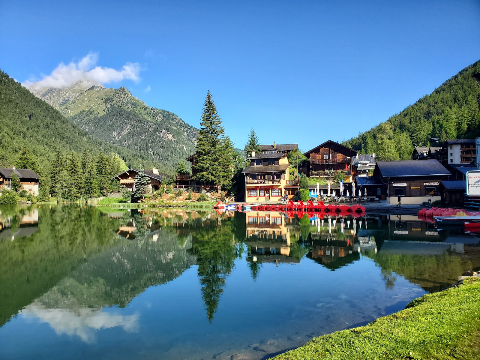
Champex is an adorable Swiss lake town with a few bars, creperies, and a nice walking path around the lake. Here we stayed at Hotel Splendide which was our favorite hotel on the entire TMB. Family owned and run, it is straight out of a Swiss fairytale with quaint courtyards, breathtaking views, tasteful decor, and an awesome glass elevator running through its center. Dinner and breakfast here were also some of the best we had. Highly recommend!
DAY 10: CHAMPEX LAC TO TRIENT
Total distance: 15km or 17.2km
Time: 6-8 hours
There are two options for today’s hike: the Bovine route which is easier in regards to elevation/descent but longer distance. Given that this route is easier it takes less time. The other option is via Arpette which is harder and takes longer but is shorter in distance.
The Bovine Route:
This route takes approximately 6 hours and covers 17.2km, but is easier. Total height gain is +700m. For this option, follow signs for TMB Bovine.
The first 4.7km is flat or downhill before ascending 600m towards Alpage Bovine at 1526m. There is a great little cafe at the top of your climb where they make excellent pies! Keep an eye out for the trail’s namesake along the way!
After the cafe you will have a short climb before a long (possibly muddy if recent rain) towards Triente. You will pass through a little town called Col de la Forclaz which has refreshments, a little shop, and ice cream. Overall an easy day, despite the mileage.
Triente is a quaint little town with a cafe and bar, but no supermarket. Stock up on snacks in Champex or Col de la Forclaz is running low. We stayed at La Grande Ourse which has both dorm and apartment style rooms. Clean and modern, the apartment was a definite upgrade from the dorms. Dinner is communal in a shared hall with other groups, and we were served a basic soup and bolognese.
The Arpette Route:
This route takes 7-8 hours to cover 15km with a total of +1184m elevation gain. This route takes longer because there is approximately double the amount of elevation gain and descent, but on a clear day you will be rewarded with excellent views. This route involves sections of rock scrambling, so it is not recommended if there was recent rain.
For this route, follow signs to Fenetre D’Arpette and continue uphill past Relais Arpette (where you can get some early refreshments). Continue uphill past the tree line following signs for TMB Arpette until you reach the boulder scramble. Take caution especially if wet or snowy!
At the top you will have awesome views of the Treint glacier and it is a great place for a picnic lunch. From the Col, the descent is steep, long, and has required multiple repairs due to landslides. Once the steep descent flattens out, follow signs to Triente.
Although this trek option is longer and more treacherous, those in our group who did it had a very memorable (albeit tiring) experience. If you have energy and good weather conditions, it is recommended!
DAY 11: TRIENT TO ARGENTIERE
Total distance: 14km – 14.7km
Time: ~7 hours
Today’s route also has two options. One is to take the Tseppes route which our guidebook recommended as more scenic, or to take the TMB route. Both are approximately 14km and both reach Col du Balme before descending. They both also have similar elevation gains, so we will describe the Tseppes route.
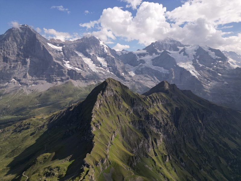
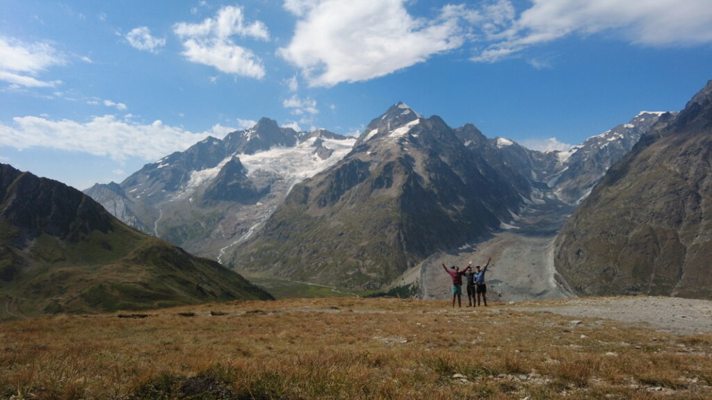
After exiting Trient, follow signs towards Tseppes. This is a hard, very steep ascent up until passing Alpage of Catogne and finally Col du Balme. This may be the steepest feeling include of the entire trip. Today’s views are also some of the most rewarding. As you climb up you will have fantastic views of Triente glacier and as you cross over the traverse your hard work will be paid off with 360* mountain views.
Refuge Col de Balme is an absolute treat on the French-Swiss border with phenomenal views and even more phenomenal food. Everything we had was delicious, especially the yogurt with hazelnut cream, mushroom grits, and chocolate cake. One of the most delicious and breathtaking stops on the entire trek. Hang out at top and soak in some of the best views TMB has to offer.
The way down is brutal decline. If you are tired, spare your knees and take the cable car to le Tour and either walk through town or catch a bus to Argentiere.
If you have the energy to hike, follow signs towards Col & Aiguilette des Posettes, another summit which will give you great views of Chamonix Valley before descending towards Tre le Champ. From here follow signs to Argentiere.
We stayed in le Dahu Hotel in Argentiere which had a great location with nice balcony views, but nothing special otherwise. Argentiere is another cute town with plenty of cute restaurants and conveniences.
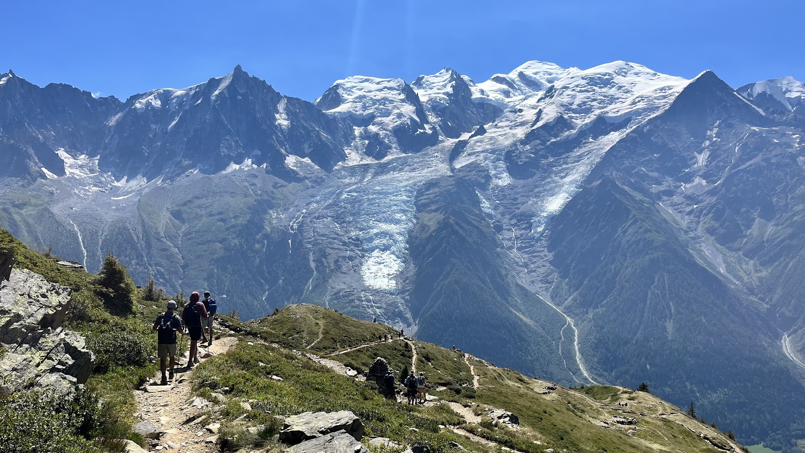
DAY 12: ARGENTIERE TO CHAMONIX
Total distance: 11.5km
Time: ~7-8 hours
This is another hard day with steep elevation gain, but equally rewarding views to culminate your TMB journey. Part of the elevation gain offers a ladders variation, which involves some rock scrambling, adrenaline-inducing ladders, and sometimes waiting in line. We had a fun time doing it, as long as you are not too afraid of heights!
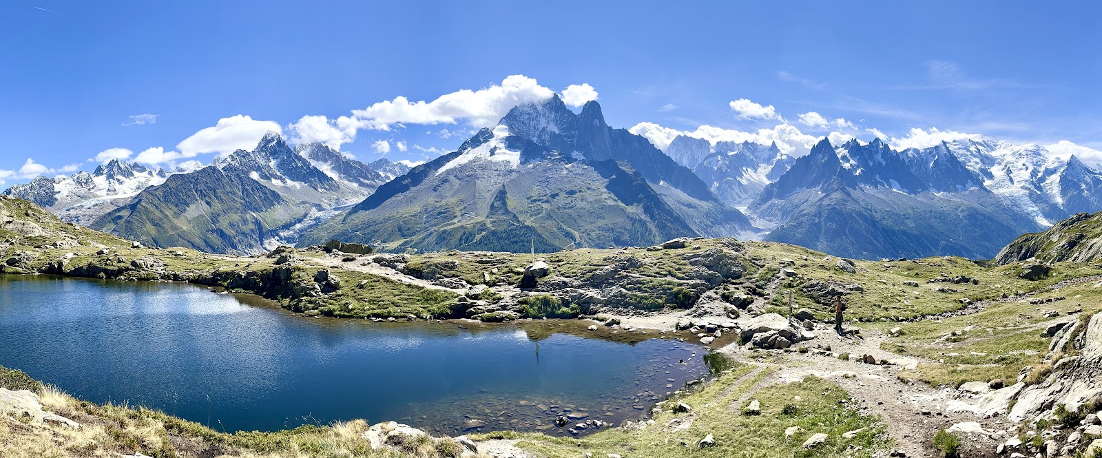
After leaving Argentiere, follow the track to the right at the first junction to do the ladders variation. Otherwise, stay towards the left and follow signs towards Flegere/Chalet des Cheserys and then towards Lac Blanc. These are the best views of Mont Blanc we had on the entire TMB!
Reward yourself with a beer, crepe, and a spectacular quiche at Refuge Lac Blanc! You have officially completed all of the ascent for the entire TMB.
From here, it is a downhill trek towards Flegere. If you are tired, take the cable car down from Flegere and walk along the water to Chamonix. This is a nice shortcut to end the journey and walking through Chamonix is charming.
If you have more energy, continue walking an additional two hours until you reach the second cable car at Plan Praz. This cable car stops running at 1700, so only continue if you know you have enough time to make it! Our guidebook recommended taking this cable car down rather than descending to Chamonix by foot as the trail is very steep.
In Chamonix, we again stayed at Point Isabelle Hotel– named after the first female to summit Mont Blanc. We celebrated with riverside drinks at Bar du Moulin Chamonix and had an amazing dinner at Le Chaudron. Everything was 5 stars delicious. Make sure you get the French toast dessert!
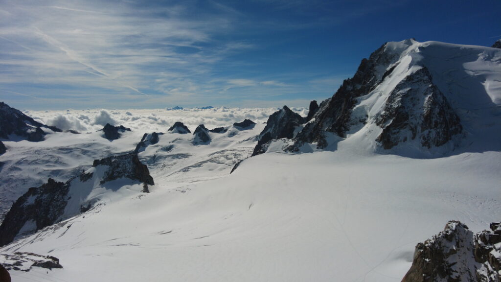
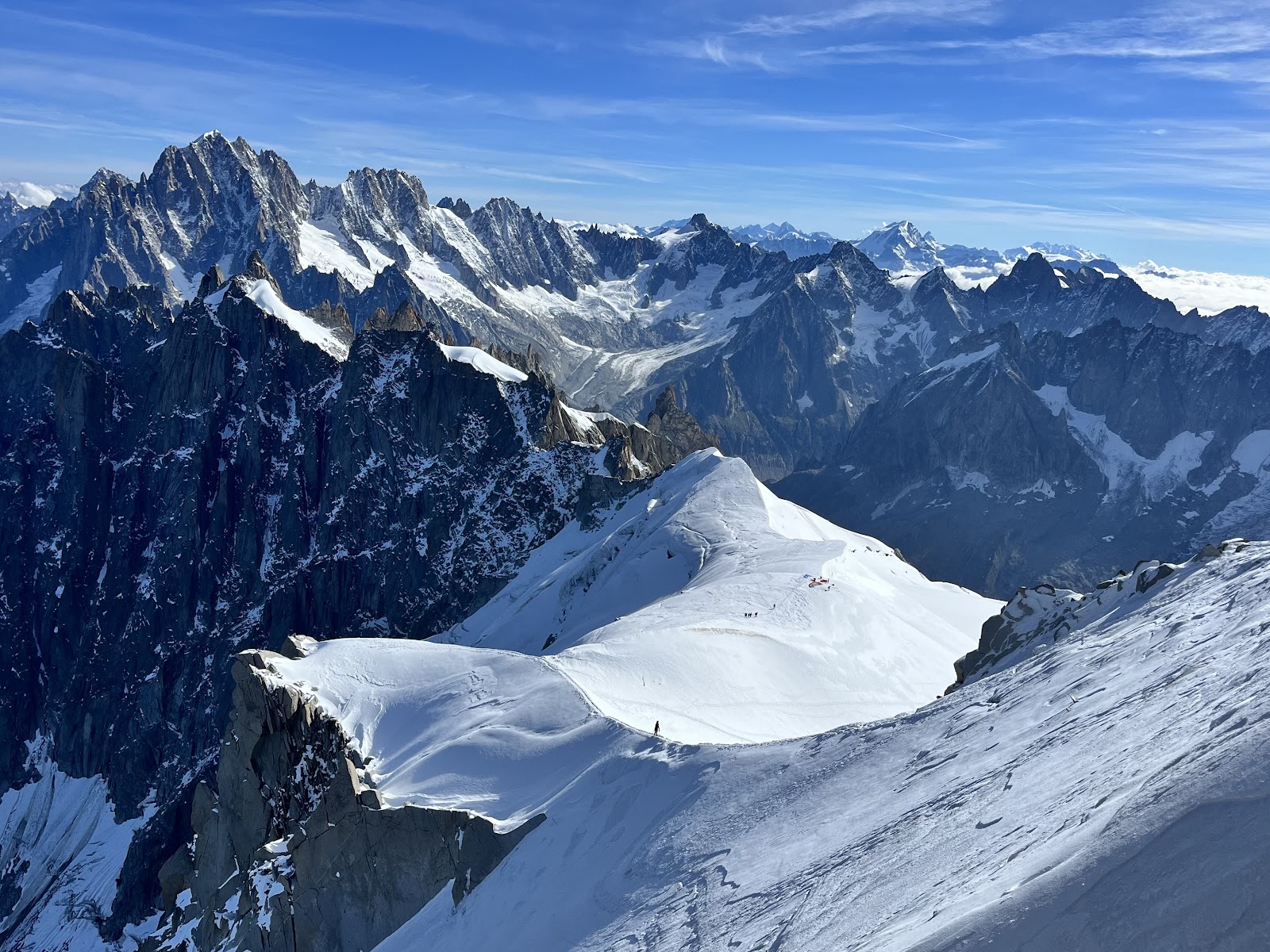
Spend some time exploring the adorable town of Chamonix. Before leaving, take the Panoramic Chamonix MB Cable Car up to the top of Mont Blanc, the peak you have been circling for the last two weeks! The views are absolutely otherworldly and it gives you an amazing appreciation of the mountain range from a totally different perspective. The best way to end your trip! Highly recommend!
SUMMARY
Hiking Tour de Mont Blanc is an extraordinary, once-in-a-lifetime adventure that promises the perfect blend of thrill and indulgence! The mix of adventure and luxury with cultural immersion in three different countries makes this trip truly unique. Whether you’re traveling with friends or setting out on a solo exploration, use Mont Blanc Treks to help book your self-guided tour (with bag transfer)! Their impeccable arrangements and seamless support ensured that our large group experienced every moment to the fullest, leaving us with nothing to worry about except soaking in the stunning landscapes and vibrant local cultures. This is a 10/10 experience that we would eagerly do again, and we wholeheartedly encourage you to embark on this incredible journey too!
MAP
Here is a link to our Google Map with all the cities, hotels, and mountain refuges for refreshments as discussed above. We hope this helps you plan your own adventure around the epic Mont Blanc!